

-2025-07-11-06-46-49.webp)

Last updated on 2025-09-18


-2025-08-29-10-44-55.svg) 9,4
9,4-2025-08-29-10-44-55.svg) 2,5
2,5 50m
50m 32m
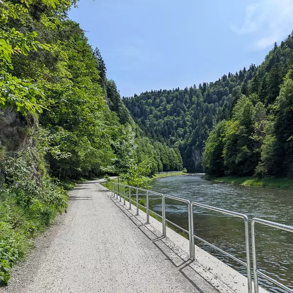
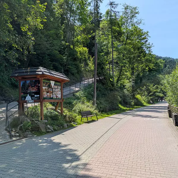
32mThe Pieniny Road begins at the rafting marina in Lower Szczawnica. It is over 9 km long, with an elevation difference of about 60 meters. The route runs through the greatest attraction of the Pieniny Mountains – the Dunajec Gorge. It ends at the mouth of the Lipnik stream in Červený Kláštor, Slovakia. The trail follows the right bank of the river and, after 1,400 meters, crosses the state border. It connects two national parks – the Polish and the Slovak – in a site particularly protected for its unique plant communities and unforgettable landscape.
The rafting harbor is located below the street, on the right-hand side, sheltered by andesite walls. It marks the beginning of the route leading upstream along the Dunajec. Just before the harbor stands the building of the Pieniny Sports Club. On the right side of the road, information boards with maps, descriptions, and photos of excursion options in the area have been placed. At the descent to the harbor, there is an obelisk dedicated to St. John Paul II.
Distance: about 200 m
On the right side of the road lies Cypel, an island on the Dunajec about 600 meters long, formed from river deposits. In 1932, a great flood destroyed it together with the “Biały Domek” guesthouse that once stood there. Over time, the river rebuilt the island, where today a sculpture commemorates the Werner family, founders of the Pieniny Sports Club. A wooden footbridge leads to Cypel. It is a good spot to rest on the lawn and admire Kotońka Rock with its highlander statue, located about 500 meters away.
Distance: about 200 m
The Pieniny Road runs parallel to Cypel Island, separated from the trail by an old riverbed of the Dunajec, which comes alive during high water when the river once again fills it. From this point, trails branch off toward Sokolica (747 m a.s.l.) in the Pieniny Mountains and to the Rozdziele Pass across the ridge of the Little Pieniny.
Here begins the steep climb to the Orlica Shelter, located about 30 meters above the road. The former guesthouse, built in 1932, was leased by the PTTK in 1951 and named after Józef Madeja, the first guide of the Pieniny branch. In 1970, the building became the property of the PTTK, and today it is managed by the Karpaty company. Next to the shelter is the Museum and Center of Mountain Tourism History.
Distance: about 100 meters
After about 100 meters, the road reaches the Piec Majki grotto, also known as the Zyblikiewicz grotto. The cave was formed through an unusual geological process: hard limestone was pushed out by older, softer shales. Under immense pressure, the limestone cracked, creating a fissure. Over time, the waters of the Dunajec widened it and shaped the grotto, whose walls today display impressive karst draperies. The name “piec” refers to the Old Polish word for a cavern.
Right next to the grotto, on the wall of a several-meter-high crag, about 5 meters above the ground, stands a small statue of the Virgin Mary. Beneath the rock is a relief map of the Pieniny Mountains and a cyclists’ rest stop (MOR) with benches and a tool stand.
Distance: approx. 330 m
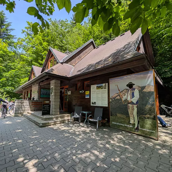
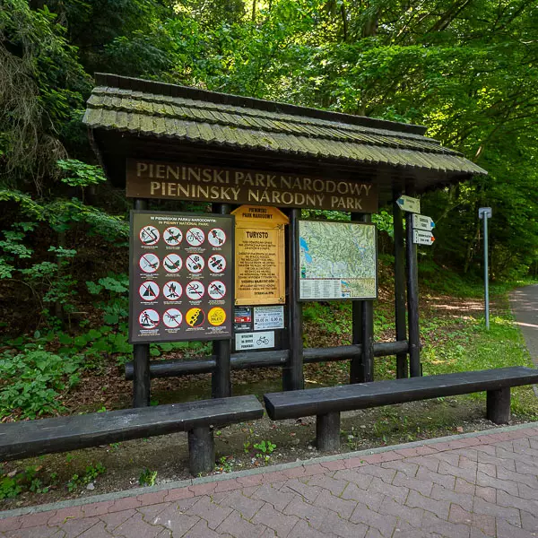
Beyond the Kacze stream, just 30 meters from the Piec Majki grotto, stands one of the five Polish entrance pavilions of the Pieniny National Park. Here you can see an exhibition devoted to the Pieniny forests, buy souvenirs, and use the restroom. Above the road, the fir forest conceals the Bystrzyk massif with its distinctive White Rock, clearly visible from the Szczawnica side.
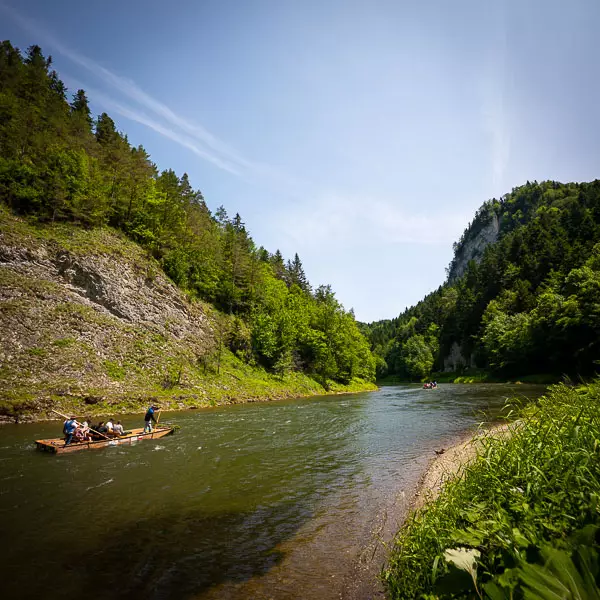
Further on, after about 200 meters, you reach Nowy Przewóz. Unlike the former transport crossing at Cypel, this one serves only tourists. At a place called Równica, the blue trail crosses the Dunajec and leads toward Sokolica. The crossing is made in a flat-bottomed wooden boat operated by a raftsman. The boat holds about 10 people and runs from mid-April to the end of October.
Right nearby, on the right side of the road, there is a rock recess with a plaque indicating the water level during the great flood of 1934. On the rock, you can also see holes that, according to legend, are traces of rifle bullets.
Distance: about 500 m
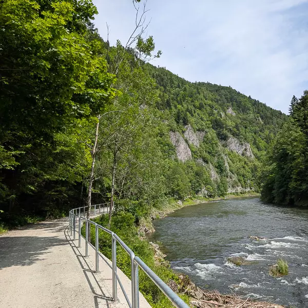
The road bends gently to the spot where the Dunajec makes a sharp left turn. On the right stretches a stony beach beneath Huk Rock, which amplifies the roar of the river. On the left, the remains of the walls of the former Zyblikiewicz shelter can be seen; it burned down under unclear circumstances in 1916.
The trail approaches the state border, which has existed here since the Middle Ages (with a short break in 1938, when Poland occupied Leśnica). In 1939, German troops entered Szczawnica along this route, but were halted by the demolition of the road and the fire of Polish soldiers. On the left side stand the foundations of a former border guardhouse.
On the Slovak side, just beyond the border, is the PIENAP pavilion with an exhibition on the ethnography and nature of the Pieniny Mountains. On the ground floor there is a bar and restroom. Next to the pavilion is the final marina of the Slovak rafting trip. On the opposite bank of the Dunajec, from 1907, there operated the Sienkiewicz shelter, which after 24 years was renamed the Pieniny Inn. Visitors reached the inn from the Pieniny Road by ferry, which cost two hellers – about 5 cents. The building was dismantled in 1938.
Distance: about 400 m
About 350 meters past the PIENAP pavilion, the Pieniny Road reaches the place where the Leśnicki Stream flows into the Dunajec. The mouth of the stream is flanked by two rocks: Wylizana on the left and Osobita on the right. Here, a plaque commemorates the victims of the Pieniny. On the steep bank of the stream once stood the Hochhauser inn, which also housed a post of the Slovak State Defense Guard. The building burned down three months before the outbreak of World War II.
On the opposite side of the Dunajec rises Przechodki Mountain with its characteristic promontory. The name refers to the old path along the river, which, before the establishment of the national park, allowed people to walk as far as the Pieniński Stream. This was the route of the popular Skalna Perć trail.
Distance: approx. 300 m
The Pieniny Road skirts Przechodni Wierch in the Pieninki range on the Polish side and enters the Haligovské Pieniny. Here the river current calms, but treacherous whirlpools form, known to raftsmen as the Loch. Tradition claimed they reached depths of up to 18 meters, although hydrographic studies have not confirmed this. The phenomenon is explained by the geology: hard limestone lies atop soft shales, just as at Piec Majki.
Three hundred meters further lies the Centennial Spring. During the Austro-Hungarian monarchy it was a fixed point of excursions. Today, however, due to nature conservation, it can only be viewed from the road.
Distance: about 1 km
For about a kilometer, the Pieniny Road runs beneath the forested slopes of Golica. On the opposite side of the Dunajec, on the Polish bank, rise the foothills of Sokolica, followed further by the cliffs of Cukrowa Skała and Wilcza Skała. In the 1920s, Walenty Gadowski, the creator of Orla Perć in the Tatras, built here a trail called Skalna Perć, leading from the Sienkiewicz Shelter through the Pieniński Stream to the Huliński Stream. Between 1934 and 1938, the trail was closed by decision of the Pieniny National Park, yet to this day iron hooks from the old chains can still be seen above the Dunajec.
Just before Polanka, on the Polish side of the river, the valley of the Pieniński Stream comes into view. The Pieniny Road descends on the left and passes a steep meadow known as Polanka, where between 1885 and 1915 the Csárda inn operated. Spa guests from Smerdžonka and Szczawnica enjoyed themselves here to the sounds of Hungarian music. Below, by the river, was a small marina with boats that carried visitors back to Szczawnica.
Distance: approx. 2.6 km
From Polanka, the Pieniny Road runs above the calmly flowing Dunajec along a long, straight section. Along the way stands a relic from the times of the Austro-Hungarian monarchy – an iron waterline marker, No. 52. On the right, on the Polish bank, rise rocky walls with niches – one of them appears on maps as the “Slovak Tourist Shelter.” In this area also tower the steep cliffs of Facimiech, with distinctive rock shapes resembling an eagle and a nun. The entire massif lies on the Polish side.
A few dozen meters past Polanka, the Pieniny Road makes a sharp turn to the left. The trail traverses beneath seven slender limestone spires on the southern wall of Golica. According to legend, these are monks from the Červený Kláštor, turned to stone for breaking their vows of chastity. Along the road, one can encounter xerothermic grasslands, rich in rare, fragrant plant species. Only after passing Huta does the full view open up of the Monks formations towering above the gorge.
Distance: approx. 1.5 km
For about 600 meters on the left side of the Pieniny Road stretches a series of small meadows. They are remnants of a 17th-century glassworks and a farming settlement, inhabited until 1969. By the tourist shelter flows a spring with a stylized wooden curb, known as the “Marriage Spring.” According to the raftsmen, a couple who drinks from it together will marry within a year.
In the 1960s, this area was considered for the construction of holiday resorts, but in the end, only the yellow trail was created, leading through the Huta stream valley to the Targov Pass. The Pieniny Road continues to the bend by Klejowa Góra, passing on the opposite bank of the Dunajec the former Zimna Polana, where hay was once transported in winter across the frozen river.
At the bend, a white mark a few meters above the road indicates the level of the great flood of 1934. Below Klejowa Góra, on the left side, stands a monument reconstructed in 2020, dedicated to Czechoslovak state officials shot in June 1920. The commemorative plaques were originally unveiled in 1928, but the monument was destroyed ten years later, after Poland took over Leśnica. According to contemporary accounts, the perpetrators were probably Poles, though today it is difficult to determine whether their motives were political or simply robbery.
From this point, a postcard-like view opens up toward Nowa Góra and Podskalnia Góra. The route then leads to Zbójnicki Skok, the place where, according to legend, Janosik leapt across the Dunajec.
Distance: approx. 1.5 km
Janosik’s Leap is the narrowest point of the Dunajec, about 12 meters wide. According to legend, this was the place where brigand candidates had to pass their exam: to leap across the river. The first to succeed was Juraj Janosik, the most famous outlaw of Slovakia and Poland, who, fleeing from the castle in Niedzica, is said to have jumped the Dunajec here. The narrowest channel also meant the greatest depth. Measurements show 4.5 meters, although the raftsmen claim the water here reaches as much as 8 meters.
In this area, by observing the neighboring rocks – Grabczychy, Świnia, and Ostra – one can see an example of the so-called bouquet structure of the Pieniny Mountains. Today, this zone is strictly protected within Zone A of the Pieniny National Park.
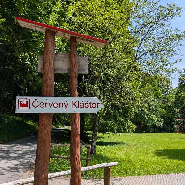
The road then leads through hornbeam forest in a widening valley. Just before the monastery lies a meadow with a PIENAP campsite. A footbridge over the Lipnik stream leads to food stalls and the buildings of the former monastic complex, now a national cultural monument.
Červený Kláštor, formerly a Carthusian and later a Camaldolese monastery, holds a special place in the Slovak national identity. It was here that Romuald Hadbavný translated the Bible into Slovak, and Brother Cyprian (Franc Jäschke) – pharmacist and author of a famous herbal – left behind works of great value.
Today, the monastery houses a museum with a modern exhibition, as well as a hotel, a brewery, and the inn “Pod Lipami.” Educational programs are also held here, including digital detox workshops. It is one of the most frequently visited places in the entire Pieniny range.